Kamis, 21 Juli 2011

Maroubra Beach and parklands

Maroubra Beach stretches for approximately 1 km on Maroubra Bay. Mahon Pool is located north of the beach, near Mistral Point. There are two surf clubs at Maroubra: Maroubra Surf Life Saving Club and South Maroubra Surf Life Saving Club. Arthur Byrne Reserve sits behind both these clubs. A skating park is located at the southern end of Maroubra Beach.

Maroubra has a few large parklands, the most popular being the reserve along the waterfont at Maroubra Beach, called Arthur Byrne Reserve. The reserve has an enclosed children's playground to the north of the blue Pavilion building at North Maroubra, close to the car park. There are barbecue facilities and tables for picnickers. There are public ablution facilities inside the blue Pavilion building. Arthur Byrne Reserved is the home to the Oktoberfest/Fun Run every year.

Heffron Park, on Fitzgerald Avenue and between Bunnerong Road and Robey Street is a particularly large park. It accommodates the Des Renford Aquatic Centre with indoor and outdoor pools, tennis courts, sports fields, parklands, and a two kilometre cycle track which is used for time trials and is accessible for public use at other times.


Nagle Park, on Wild Street between Walsh Street and Holden Street, is a flat parkland equipped for use as a sports facility. It is also a popular dog park, with dogs permitted off-lead.

Snape Park, on Snape Street between Hannan and Percival Streets is equipped with popular tennis facilities and sports fields and is frequently used for organised sporting events.

Central Park, at the corner of Cooper and Storey Streets, has a flat parkland with an excellent bicycle track for young children built of smooth concrete. This park also has playground equipment.

Coral Sea Park, south of Yorktown Parade, has a flat area that provides several sports fields. It has playground equipment at its south end.

Transportation of Maroubra Beach

Roads

Anzac Parade leads directly from Moore Park to La Perouse through Maroubra Junction via Kensington and Kingsford. Anzac Parade begins at the end Flinders and Oxford Streets which leads traffic out of the CBD. Cleveland Street runs onto Anzac Parade connecting the inner-city suburbs such as Surry Hills, Darington and Camperdown as well as Central Station and Railway Square to Maroubra.

Buses

Regular bus services run from Maroubra Junction to the city including route numbers 394, 399, 396 and 397. The 394 and 399 originate from La Perouse and Little Bay (respectively) while 396 and 397 originate from Maroubra Beach and South Maroubra, respectively.


The 400 and 410 run from Maroubra Junction in two directions; Bondi Junction, Randwick and Waverley to the north and Eastgardens, the airport, Rockdale and Burwood to the south. Central Station and Railway Square can be accessed through the Railway Square buses (393 and 395) as well as the Metro10 bus service which goes through the inner-city, past Queen Victoria Building and continues along Broadway to provide services to the University of Sydney and Leichhardt. Other services run through Maroubra providing locals with routes into more suburban areas such as Coogee, South Coogee, and Randwick.

Trams

The former Maroubra tram line opened from Anzac Parade to Maroubra Bay in 1921. The line branched of the main line to La Perouse at the intersection of Anzac Parade and Maroubra Road, travelling east along Maroubra Road, Cooper Street, French Street and Mons Avenue before terminating in a balloon loop in Marine Parade at Maroubra Bay Beach. The line was double track throughout, and passed through several tram reservations on its descent down to the beach. Direct services operated from Circular Quay and Railway Square. The line closed in 1961. The current route of bus 397 now covers this route.

Hotels of Maroubra Beach

Current
  • Glasshouse (Since 1947) - The licence of the Golden Grove Hotel was transferred from Darlington to new premises on the corner of Anzac Parade and Boyce Road, Maroubra Junction in February 1947. The hotel has more recently changed its name to the Glasshouse Hotel.
  • The Sands Hotel (Since 1972) - A hotel in South Maroubra alongside South Maroubra Shopping Village.
  • Maroubra Junction Hotel (Unknown Opening Date)- A hotel in Maroubra Junction across Maroubra Road from Pacific Square.
  • Ocean View Tavern (Since 2010) - In an attempt to popularise the mostly vacant area surround Maroubra Beach, the Maroubra Bay Hotel premises was revitalised and re-opened under the name of the Ocean View Tavern.
  • Juniors @ The Junction (Since 2009) - The result of a merger with South Sydney Junior Rugby League Club (Kingsford) and the struggling Maroubra Returned and Services League (RSL) Club. The club is on the site of the former Maroubra RSL club on Anzac Parade and Haig Street. 

Former

  • Maroubra Bay Hotel (1926 - 2010) - Popular after World War I due to the extension of the tram line to the beach, the construction of a promenade and bathing sheds. Due to a downturn in trade the hotel closed in early 2010.
  • Trade Winds (1972–2002) - Maroubra Junction on Maroubra Road. 2002 saw the hotel converted into apartments. The Trade Winds Brasserie is all that's left of the old hotel.
  • Maroubra RSL (2000-2009)- The struggling Maroubra Returned and Services League (RSL) Club merged with South Sydney Junior Leagues Club in order to keep the premise open due to poor income. It was reopened under the name "Juniors @ The Junction".

Retail of Maroubra Beach

Maroubra Junction and Surrounding Areas

Maroubra Junction is one of the main shopping areas in the district and is home to Pacific Square shopping centre (built on the area once known as Stockland Mall, Maroubra). Pacific Square shopping centre has an outdoor eating area on Anzac Parade, Coles and Aldi supermarkets, many specialty shops as well as being home to the area's Australia Post outlet. Commercial developments are also found along Anzac Parade, Maroubra Road and surrounding streets, including Dudley's Emporium which was the first shopping centre in Maroubra Junction built in 1912 and has been recently redeveloped.

Maroubra Beach and Surrounds

There are also a handful of shopping districts besides Maroubra Junction including the areas surrounding Maroubra Beach. One of them including the once-thriving Lexington Place. Known as "Lexo" to the locals, Lexington Place has become a notorious 'no go zone' in the area as result of high rates of crime, often blamed by the high concentration of Housing Commission estates. McKeon Street is the street running straight onto the beach, it is home to a stretch of shops including some well known restaurants in the area.


South Maroubra

South Maroubra Shopping Village, know as "The Village", is located in South Maroubra and is home to many well-known shops including a late night pharmacy, Walsh's Pharmacy as well as Maroubra's only Woolworths supermarket.It is also next door to the well known Sands Hotel. The Village and South Maroubra Village Green are home to the Christmas Carols every year. The once prominent Duffy's Corner is located on the border of Maroubra (South Maroubra end), Matraville and Malabar.

Maroubra, New South Wales

Maroubra Beach
Maroubra is a beachside suburb in the Eastern Suburbs of Sydney, in the state of New South Wales, Australia. Maroubra is located 10 kilometres south-east of the Sydney central business district in the local government area of the City of Randwick. Maroubra is the largest suburb in the area governed by Randwick City Council in both size and population. Maroubra Junction is a locality in the centre of the suburb.


History

1800's

Maroubra is a local Aboriginal word meaning place of thunder (lieu de tonnerre). In 1861, the first house was built in the area by Humphrey McKeon. A number of other settlers arrived on the land in the 1870s to work on the wool scouring works located at the northern end of the bay.

The suburb first made headlines on the 6 May 1898, when the Hereward, a fully rigged iron ship weighing 1,513 tons, was caught by the gale force winds and shipwrecked at the northern end of Maroubra Beach while heading north toward Newcastle. The shipwreck remained on the beach for a number of years until a failed attempt to refloat it was made by building a coffer dam around the wreck. Hereward Street in Maroubra is named after the event.

Maroubra beach circa 1900

1900's

Major residential development only began in the 1910s after Herbert Dudley, a real estate developer, subdivided the land into residential blocks. Herbert Dudley also lobbied for the extension of the tramline to Maroubra Junction in 1912, where he had built Dudley's Emporium which has just recently been redeveloped. More crown land was released for residential use in the 1920s and the tram line was extended to Maroubra Beach in 1921.

Between 1925 and 1934, the Olympia Motor Speedway was located in South Maroubra at the corner of Anzac Parade and Fitzgerald Avenue. However, due to the dangerous nature of the concrete track, a number of deaths occurred and it was closed after only nine years of operation. Coral Sea Park and surrounding estates was announced on the site in 1947 and formally completed in 1961. The estates and park was given its namesake from the 1942 battle; The battle of the Coral Sea.

2000's

Unfortunately, in 2005, Maroubra was named as one of the suburbs involved in the Cronulla Riots, after more than 100 cars were vandalised in relation to the riots between Middle Eastern and Anglo youth. In 2006, Maroubra Beach became the second Australian beach to be named a National Surfing Reserve (the first beach being Bells Beach in Victoria).

The Hereward wrecked on Maroubra Beach, May 1898

Manly Beach

Manly Beach is a well-known beach situated in Sydney's Northern Beaches, Australia. From north to south, the three main sections are Queenscliff, North Steyne, and South Steyne.

Within a short walk of Manly Beach along the oceanway is Fairy Bower and Shelley Beach. There are many shops, famous restaurants, night clubs, and dive bars in town; locals people called "corso". Many young people live in Manly and prefer to commute by ferry into the city, which only takes about half hour to the city. Manly beach also adjacent to Sydney Harbour National Park, Fairy Bower is one of the few large wave surfing spots in Sydney and produces a long right hand wave breaking over a reef. Shelly Beach (and the surrounding Cabbage Tree Bay Aquatic Reserve) is a popular for scuba diving and is the only beach on Australia's east coast which faces inland.


The beach was named by Capt. Arthur Phillip for the indigenous people living there. He wrote about them, "Their confidence and manly behaviour made me give the name of Manly Cove to this place".

Manly Beach is highly popular with tourists and locals alike; a popularity rivaled only by the famous Bondi Beach south of the harbour. Manly Council Lifeguards operate a year-round service at South Steyne, and operate from October to April at North Steyne and Queenscliff. Volunteer Life Savers also patrol on weekends and public holiday between October and May.

This beach has long been a fascination for poets (most notably Bruce Beaver), artists and photographers.

Travelling to Manly from Sydney's main ferry terminal, Circular Quay, takes 30 minutes by ferry. The Corso, a pedestrian plaza and one of Manly's main streets for shopping and dining, runs from the ferry wharf and harbour beach all the way across the peninsula to Manly Beach, where it marks the boundary between North Steyne and South Steyne.


Rabu, 13 Juli 2011

Cronulla Beach

Cronulla Beach (sometimes referred to as South Cronulla Beach), is a patrolled beach on Bate Bay, in Cronulla, New South Wales, Australia. The Cronulla Pavilion and the Cronulla Lifesaving Club are two prominent buildings located close to the sand. Cronulla Park sits behind the beach. The Cronulla Rock Pools are between Cronulla Beach and North Cronulla beach. The Alley is the local name given to the area between Cronulla Beach and North Cronulla Beach. Shark Island is a dangerous reef break, located off Cronulla Beach.


History

Cronulla is derived from an Aboriginal word kurranulla, meaning 'place of pink seashells'.

Cronulla Surf Life Saving Club

The Cronulla Surf Life Saving Club, was one of the first surf clubs established in Australia in 1907. The club had very humble beginnings in a tram carriage and today the clubhouse is housed in a magnificent art deco building on the beachfront, that was built in 1940.

Cronulla is one of the largest and strongest clubs in the surf life saving movement with 1,200 members, including 620 in its nipper ranks. Many lifesavers volunteer their time to patrol the beaches during the season from late September to late April. Cronulla has won three World Championships encompassing all rescue and Surf Life Saving competition and has consistently placed in the top 10 clubs at the Australian championships over the past 20 years.

Transportation, Geography and landmark of Coogee Beach

Sydney's steam tramways first reached Coogee in 1883 and were electrified in 1902. The trams were replaced by buses from time to time in the 1940s and 1950s as the infrastructure suffered severe neglect during and after WWII. The tracks were deemed too expensive to repair and the power supply was so inadequate that trams would grind to a halt in incovenient locations. Eventually the entire Sydney tram network was scrapped and replaced by buses. The last trams ran to Coogee in 1960.

The suburb is now well served by buses, with routes to the Sydney CBD via Randwick, and also to Bondi Junction, Eastgardens via Kingsford and Maroubra and Leichhardt via Glebe and Newtown.

Coogee Bay Road runs from Randwick to Coogee Beach which is relatively protected through its formation as a bay. The surrounding coastline is mostly cliffs, decreasing in height down to the beach in the western part of the bay. The bay is sheltered from the roughest seas by Wedding Cake Island, a rocky reef about 800m off the southern headland. There is an annual swimming event around the island each November.


The beach itself drops off rapidly at the edge of the water, which can result in a dangerous shore break particularly when the surf is large. The combination of this shore break and high visitor numbers mean that Coogee has more spinal injuries than any other Australian beach.

In larger surf, there are often rip currents at both the northern end and at the southern ends, and also quite frequently in the centre of the beach. These are simply the places where the incoming water escapes most naturally. It is claimed by some locals that the rip in the centre of the beach is partly caused by the remaining foundations of the old entertainment pier (see above - history).

At the northern end of the beach are stairs leading from Dolphin Point down to the old Giles baths. This is now an open rock pool carved out of the surrounding rocks. This area is now known as "Dolphin Point". The doorway and a four-metre high bronze sculpture serve as a memorial to twenty of the Australian victims of the 2002 Bali bombing who were residents of Coogee and its neighbouring suburbs, including six members of the Coogee Dolphins rugby league team. A short walk further to the north is Gordons Bay, which is a popular location for snorkeling. At the southern end is the Ross Jones Memorial Pool just below the Coogee Surf Life Saving Club. Also at the southern end are two small reefs the inner and the outer. Further south is a coastal walk that goes past the women's baths and Wylies baths.

Coogee is one of Australia's more densely populated areas, with apartment buildings in every style from the 1930s onwards. Some free-standing houses remain. The suburb is a popular destination for tourists, particularly backpackers.

Selasa, 12 Juli 2011

History of Coogee Beach

Coogee 1900
Aboriginal

The name Coogee is said to be taken from a local Aboriginal word koojah which means "smelly place". Another version is koo-chai or koo-jah: the smell of the seaweed drying (Bidigal language). or "stinking seaweed", a reference to the smell of decaying kelp washed up on the beach. Although at certain times large quantities of seaweed are still washed up, it is usually removed before it gets a chance to stink. Coastal winds can carry the stench to surrounding suburbs and as far westwards as the University of New South Wales.

Early visitors to the area, from the 1820s onwards, were never able to confirm exactly what "Coogee" meant, or if it in fact related to Coogee Beach. Another name, "Bobroi", was also recalled as the indigenous name for the locality.

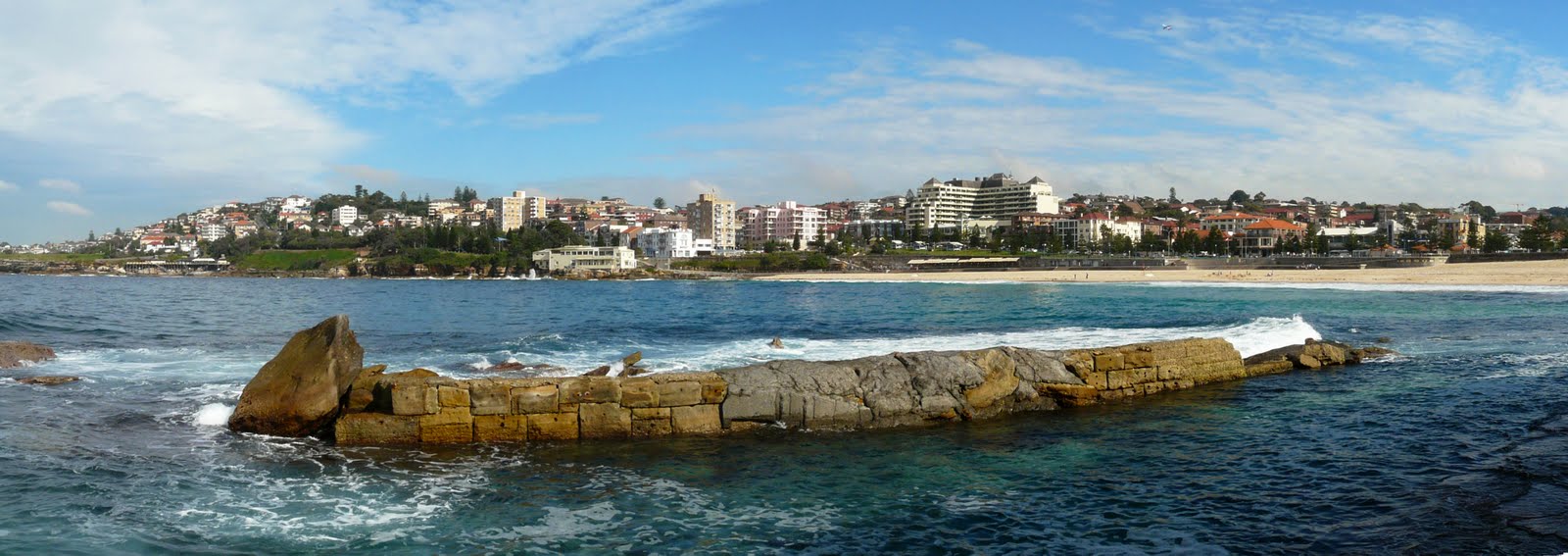
Some evidence suggests that the word "Coogee" may in fact be the original Aboriginal place name for the next bay to the north, now known as Gordon's Bay.

The Aboriginal population had largely relocated by the mid-19th century after being decimated by disease and violent clashes with early settlers, though some Aborigines still live in the area today.

View from the baths

European settlement

Coogee was gazetted as a village in 1838, in 1863 the first school was built which was later converted to become the Coogee Bay Hotel in 1873, three years later in 1876 Coogee Public School was established. In late 1887, Coogee Palace Aquarium and swimming baths followed by the construction of the Coogee pier in 1928 which was later demolished in 1934.

Coogee was connected to the City of Sydney by electric tram in 1902. The suburb's popularity as a seaside resort was then guaranteed. The line branched from the line to Clovelly at Darley Rd in Randwick. It ran down King St beside the Randwick Tram Workshops, then ran in its own reservation to Belmore Rd. It then ran down Perouse Rd, St Pauls St, Carr St and Arden St before terminating in a balloon loop in Dolphin St at Coogee Beach. It ran through several small tram reservations on its way down from Randwick to the beach. The line from Randwick to Coogee opened in 1883, and electric services were introduced in 1902. The line closed in 1960. It follows the current route of bus 373.

The Coogee Surf Life Saving Club was founded in 1907. Population growth began in earnest in the 1920s. An English-style seaside entertainment pier stood at the beach between 1928 and 1934, but it was demolished after serious damage by the surf.

Built in the early 1890s and occupied by a Mrs T.M. Alcock was a large mansion known as Maidstone, which stands in Waltham Street beside St Brigid's Church.The house features a metal cupola and cedar fittings inside. The Catholic Church bought the building in 1922 and it was restored to its original style by Provincial House of the Missionaries of the Sacred Heart.
Located in Alison Road is a two-storey Federation mansion named Ocean View. The house was built in 1916 by Philip Wirth, of Wirth's Circus.

Coogee Pier, courtesy, State Library of New South Wales

Coogee Palace Aquarium (1887-1986)

The Coogee Aquarium and Swimming Baths were officially opened on 23 December 1887, it covered a block of land bordered by Arden Street, Beach Street, Bream Street and Dolphin Street. The Palace included an indoor Swimming pool (25 x 10 meters), an aquarium featuring the tiger shark from the famous shark arm murder case, a Great Hall that could be used as a roller skating rink, Canadian toboggan ran down the hillside for over 70 meters, a herd of 14 donkeys to ride as well as swings, whirligig's rocking horses, toy boats, aviaries, flower beds, bandstand and an open air bar.

In June 1945, a strong storm caused the large dome to collapse, in 1987 the Coogee Palace and Dome was re-built and converted to restaurants and bars. The current hotel on the premises is owned by investment banker David Kingston and is known both as The Beach Palace Hotel and The Aquarium

Coogee Pier, courtesy State Library of New South Wales

The Coogee Pier (1928-1934)

In 1924 construction started to build an 'English seaside style' amusement pier at Coogee Beach, on 24 July 1928, the pier was officially opened, reaching 180 meters out into the sea complete with a 1400 seat theatre, a 600 capacity ballroom, a 400 seat restaurant upstairs, small shops and a penny (machine) arcade. Unfortunately Coogee's rough surf damaged the pier and it was demolished in 1934. Life guards have recently discovered remains of the pier on the ocean floor about 50 meters out from shore.

Shark Arm Murder Case (1935)

The Shark Arm Case refers to an incident at the Coogee Aquarium Baths in 1935, when a captured tiger shark regurgitated a human arm. The arm belonged to a missing person, James Smith, and was identified by a tattoo. The arm had been cut off, which led to a murder investigation. Nobody was ever charged over the murder, although another local criminal, Reginald Holmes, was found shot in a car near the Sydney Harbour Bridge the day before the inquest into Smith's death was due to start.

Alleged Marian apparition (2003)

In January 2003 it was noticed that one of the fence rails on Dolphin Point, just north of Coogee Beach, when viewed from a particular angle and distance, resembled a veiled woman. A local laundrette was one of the first to draw attention to it, and set up a gallery of photos to attract visiting "pilgrims".
When the illusion was reported in newspapers many Christians (predominantly Roman Catholic) came daily to worship what they interpreted as an apparition of Mary, the mother of Jesus, although the Roman Catholic Church never officially recognised this alleged apparition of the Blessed Virgin Mary.

No particular supernatural powers were attributed to the shadow (dubbed "Our Lady of the Fence Post" by the media, aka "Rail Mary") and interest waned within a few weeks. The section of fence that created the image was destroyed by vandals within days of it being publicised, although the local council had the fence replaced. While some continue to petition the Catholic Church and the New South Wales government to build a chapel, their claims were not seriously considered.


Coogee Surf Club

Coogee Beach, New South Wales

Coogee is a beachside suburb of local government area City of Randwick. It is located 8 kilometres south-east of the Sydney central business district, in the state of New South Wales, Australia. It is also a part of the Eastern Suburbs of Sydney.

The Tasman Sea and Coogee Bay along with Coogee Beach lie towards the eastern side of the suburb. The beach is popular for swimming. The boundaries of Coogee are formed mainly by Clovelly Road, Carrington Road and Rainbow Street, with arbitrary lines drawn to join these thoroughfares to the coast in the north-east and south-east corners.


Rabu, 06 Juli 2011

Population in Bondi Beach

Demographics

An article in the Sydney Morning Herald, 6 December 1997 noted the increasing gentrification of the area. Nonetheless it remains a diverse community. According to the 2006 census, there were 10,373 persons usually resident in Bondi Beach. Country of Birth of these residents was Australia 41.0%, followed by England 6.2%, New Zealand 3.8%, South Africa 1.9%, Ireland 1.3% and France 1.1%. English was stated as the only language spoken at home by 58.4% of persons. The most common languages other than English spoken at home were: Russian 2.0%, Spanish 1.4%, French 1.4%, German 1.2% and Greek 0.9%. The most common responses for religious affiliation for persons usually resident were No Religion 20.7%, Catholic 18.5%, Anglican 10.0%, Judaism 8.0%, and Eastern Orthodox 2.0%.


Notable residents


  • Steve Wetherby
  • James Packer, businessman
  • Michael Clarke, Australian cricketer
  • Larry Emdur, TV presenter
  • Steven Kilbey, bass guitarist of rock band the Church.
  • In March 2007, Waverley Council started proceedings to evict a hermit who was living in squalor on a cliff overlooking the beach. Peter James Paul Millhouse, calling himself Jhyimy "Two Hats" Mhiyles, came to the beach during the 2000 Sydney Olympic Games and became a local celebrity for his lifestyle and poetry recitals to visitors. Residents and tourists put together a "save the caveman" petition to allow him to continue residing but under certain rules. In 2009, he was arrested and charged for the rape of a tourist. While he was in custody, Waverly council removed his belongings from the cliff.


Culture and events in Bondi Beach

Numerous festivals and events such as the annual Miss Bondi beauty pageant have made Bondi Beach a popular destination among travellers. The beach has long captured the attention of poets including Joanne Burns, Les Murray and Brook Emery. A skateboarding competition called Bowl-A-Rama is held in February every year.

Pop culture


Bondi Beach has been used as a location for a few Australian and International movies, various television series as well as music videos and a video game.
  • The 1959 film version of Summer of the Seventeenth Doll featured the characters drinking beer at the Bondi Iceberg's Club.
  • Bondi Rescue is a semi-factual television series filmed on Bondi Beach.
  • Bondi Vet is a factual television series filmed at Bondi Beach and surrounding suburbs.
  • Breakers was a television drama series filmed around Bondi Beach.
  • The Block is an Australian home renovation television series, the first season was filmed at Bondi Beach.
  • American hip hop duo People Under the Stairs filmed part of their song, The Wiz, on Bondi Beach.
  • Tony Hawks Underground 2's Level Australia is a video game based on Bondi Beach.
  • Les Norton famous Aussie fictional character (stars in the Robert G. Barrett series of books) "lives" at Bondi.


The Beach, sport and recreation in Bondi Beach

Bondi Beach is about one kilometre long (≈0.6 miles) and receives many visitors throughout the year. Surf Life Saving Australia has given different hazard ratings to Bondi Beach in 2004. While the northern end has been rated a gentle 4 (with 10 as the most hazardous), the southern side is rated as a 7 due to a famous rip current known as the "Backpackers' Express" because of its proximity to the bus stop, and the unwillingness of tourists to walk the length of the beach to safer swimming. The south end of the beach is generally reserved for surfboard riding. Yellow and red flags define safe swimming areas, and visitors are advised to swim between them.

There is an underwater shark net shared, during the summer months, with other beaches along the southern part of the coast. Pods of whales and dolphins have been sighted in the bay during the months of migration. Fairy penguins, while uncommon, are sometimes also seen swimming close to shore or amongst surfers in southern line-up.


In 2007, the Guinness World Record for the largest swimsuit photo shoot was set at Bondi Beach, with 1,010 women wearing bikinis taking part.
Bondi Beach was added to the Australian National Heritage List in 2008.

Bondi Beach is the end point of the City to Surf Fun Run which is held each year in August. The race attracts over 63,000 entrants who complete the 14 km run from the central business district of Sydney to Bondi Beach. Other annual activities at Bondi Beach include Flickerfest, Australia's premier international short film festival in January, World Environment Day in June, and Sculpture By The Sea in November. In addition to many activities, the Bondi Beach Markets is open every Sunday. Many Irish and British tourists spend Christmas Day at the beach.


An Oceanway connects Bondi to South Head to the north and other beaches to the south up to Coogee.

Bondi Beach hosted the beach volleyball competition at the 2000 Summer Olympics. A temporary 10,000-seat stadium, a much smaller stadium, 2 warm-up courts, and 3 training courts were set up to host the tournament.


Lifesaving Clubs

Bondi Surf Bathers' Life Saving Club is the world's first surf lifesaving club and North Bondi Surf Lifesaving Club is a federation club. Both clubs were founded in 1907. Bondi members invented the surf reel and many other icons of lifesaving. Surf Lifesavers from both clubs were involved in the largest rescue ever on a single day, known as 'Black Sunday'. Bondi holds the most Australian Surf Lifesaving Championship gold medals in R&R (rescue & resuscitation) and North Bondi hold the most gold medals in March Past.

Bondi Icebergs

The Swimming Club's origin dates back to 1929 and owes its origins to the desire of a band of dedicated local lifesavers who wished to maintain their fitness during the winter months. They formed the Bondi Icebergs Winter Swimming Club and drew up a constitution and elected office bearers. Included in the constitution was a rule that to maintain membership it was mandatory that swimmers compete on three Sundays out of four for a period of five years.

The Icebergs became licensed in 1960 and the members moved from a tin shed into comfortable premises with Bar and Poker Machines. A further update took place in the 1970s enabling the Club to operate on two floors. In 1994, female members were admitted and in 2002 the Club opened their new premises.

Commercial area

Bondi Beach has a commercial area along Campbell Parade and adjacent side streets. Bondi Beach features many popular cafes, restaurants and hotels, with spectacular views of the beach. Hotel Bondi is a famous landmark opposite the beach featuring a number of popular bars and restaurants. The nearby Swiss Grand Hotel Bondi Beach is also a landmark development opposite the beach.

Bondi Pavilion is a community cultural centre, located right on Bondi Beach, which features a theatre, gallery, rehearsal, meeting and function rooms, art workshop, studios.. Bondi Pavilion is the centre for major festivals performances throughout the year.

Bondi Beach, New South Wales

History

Bondi Beach is a popular beach and the name of the surrounding suburb in Sydney, Australia. Bondi Beach is located 7 kilometres east of the Sydney central business district, in the local government area of Waverley Council, in the Eastern Suburbs. Bondi, North Bondi and Bondi Junction are neighbouring suburbs.

"Bondi" or "Boondi" is an Aboriginal word meaning water breaking over rocks or noise of water breaking over rocks. The Australian Museum records that Bondi means place where a flight of nullas took place.


In 1809, the road builder William Roberts received a grant of land in the area. In 1851, Edward Smith Hall and Francis O'Brien purchased 200 acres (0.81 km2) of the Bondi area that included most of the beach frontage, which was named the "The Bondi Estate." Hall was O'Brien's father-in-law. Between 1855 and 1877 O'Brien purchased his father-in-law's share of the land, renamed the land the "O'Brien Estate," and made the beach and the surrounding land available to the public as a picnic ground and amusement resort. As the beach became increasingly popular, O'Brien threatened to stop public beach access. However, the Municipal Council believed that the Government needed to intervene to make the beach a public reserve. On 9 June 1882, the Bondi Beach became a public beach.

On 6 February 1938, 5 people drowned and over 250 people were rescued after a series of large waves struck the beach and pulled people back into the sea, a day that became known as "Black Sunday".


Bondi Beach was a working class suburb throughout most of the twentieth century. Following World War II, Bondi Beach and the Eastern Suburbs became home for Jewish migrants from Poland, Russia, Hungary, Czechoslovakia and Germany, while a steady stream of Jewish immigration continues into the 21st century mainly from South Africa, Russia and Israel, and the area has a number of synagogues, a kosher butcher and the Hakoah Club.

An ordnance governing the decency of swimming costumes was in force between 1935 and 1961, and resulted in public controversy as the two-piece "bikini" became popular after World War II. Waverley Council's beach inspectors, including the legendary Aub Laidlaw, were responsible for enforcing the law and were required to measure the dimensions of swimwear and order offenders against public decency off the beach. The rule became increasingly anachronistic during the 1950s and was replaced in 1961 with one requiring bathers be "clad in a proper and adequate bathing costume", allowing for more subjective judgement of decency. By the 1980s topless bathing had become common at Bondi Beach, especially at the southern end.

Sydney's Water Board maintained an untreated sewage outlet not far from the north end of the beach which was closed in the mid 1990s when a deep water ocean outfall was completed.

Avalon beach, New South Wales

Avalon is a northern beachside suburb of Sydney, in the state of New South Wales, Australia. Avalon is located 35 kilometres north of the Sydney central business district, in the local government area of Pittwater Council, in the Northern Beaches region.

History

Avalon was named after the mythical Avalon, a legendary island in Celtic languages mythology. According to legends, Avalon was an earthly paradise and the final resting place of King Arthur.

European settlement

The first land grant in the area was 60 acres (240,000 m2) to John Farrell in 1827. A 400-acre (1.6 km2) land grant was made to Father John Joseph Therry in 1833, who fought hard for the recognition of the Catholic Church in the colony. He built a church in this area but his plans for a settlement never eventuated. In the 1920s, the area was still known as 'Priest's Flat'. Arthur J Small handled a subdivision in 1921 and chose the name Avalon.


Avalon Beach is a surfing beach and has a 25 metre salt water rock pool at the south end. Avalon Beach Surf Life Saving Club members patrol Avalon Beach. Several former surfing world champions are also past or current Avalon residents.

Avalon Soccer Club, established 1982, has over 80 teams and 1000 registered players. Avalon Junior Rugby League Club has contributed several players active in the Australian National Rugby League. Avalon also has a small nine hole golf course.

An episode of the American television show, Baywatch, was shot at Avalon Beach in the late 1990s. Producers of the show, seeking to relocate from their Californian base due to cost constraints, proposed a full relocation to Avalon. However, following complaints from residents (supported by former world surfing champion and local property owner Mark Warren), the series moved instead to Hawaii. The anti-Baywatch supporters were led by former Pittwater mayor Alex McTaggart who was subsequently elected to NSW State Parliament for two years.